How Do Submarines Navigate Underwater?
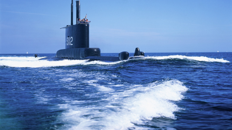
Unlike large vessels traveling on the ocean's surface or most other vehicles on the planet, military submarines do not have windows. A submarine's commander can't tell their helmsman to hang a right at the next sea mount to get to their destination. They also can't rise to the surface. Not only would that be an inefficient design, but it would be counterintuitive, too, since subs are meant to be hidden and being on the surface would risk detection. Instead, they rely on an intricate network of systems as well as a submariner's skills to navigate the deep. Even with these systems, navigation is difficult and some submarines still hit underwater mountains.
While traversing the ocean's surface, submarines take advantage of satellites with global positioning systems (GPS). This relays a submarine's exact location and is the most precise instrument at their disposal. However, GPS fails to function accurately when submarines submerge. For the crew to know their location while underwater and find where they're going, submarines rely on the Inertial Navigation System (INS). This system uses accelerometers and gyroscopes to keep track of the submarine's position in relation to its starting point.
A submarine's other navigational systems
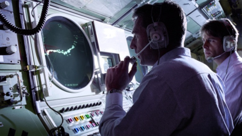
Sonar is the most well-known navigational system submarines use, informing the crew of underwater topography, potential threats, as well as the presence of marine animals. There are two types of sonar: Passive and Active. Active sonar sends out a burst of sound. Once that sound hits an underwater object, it bounces back at the sub and the computers calculate the object's distance from the submarine. This is similar to dolphins and whales when they're looking for prey. While it's necessary to use active sonar, especially when there's no sound from external sources, it's also risky because enemy ships can pick up on the ping and locate the submarine.
Moreover, active sonar can have terrifying effects on humans. That's partly why submarines also have passive sonar. This version of sonar is always listening, picking up sounds from nearby objects — often even the submarine itself. However, if submarines only had sonar, navigating the ocean would be more challenging because it doesn't pinpoint their precise location.
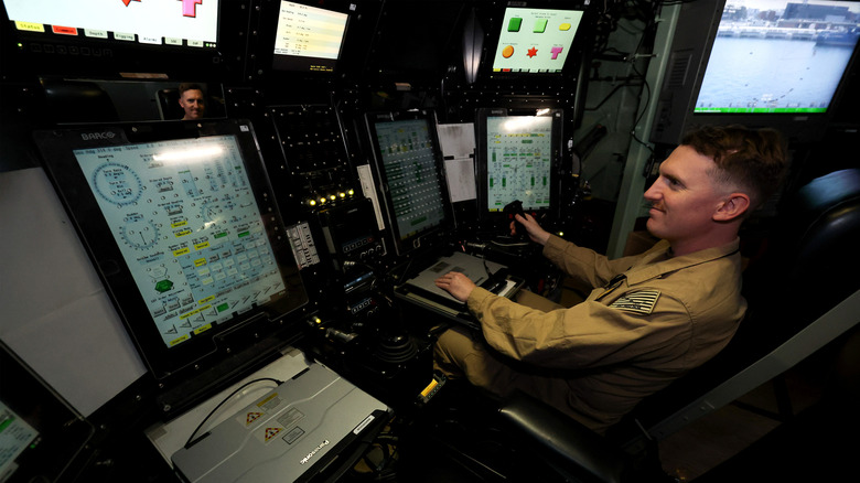
In addition to all of the advanced sensors and technology submarines have, the crew also uses up-to-date charts and graphs. Sonar can help confirm nearby objects seen on the charts, as well as water depth.
Accurate sea charts are just as important as GPS
The underwater environment is an unforgiving one. Driving a submarine is no easy task and when you throw strong currents and obstacles into the mix, it's even more challenging. A Los Angeles-class nuclear attack submarine, the USS San Francisco, crashed into an uncharted seamount in 2005, resulting in 98 injuries and one death. This was the result of outdated charts, as the San Francisco's was from 1989. It's a time-consuming process to create sea charts. Surface ships have to be sent out to an area to use multi-beam sonar, a process that blankets the seafloor in sound waves.
That wasn't the last time such an event happened, either. The USS Connecticut, a Seawolf-class submarine, did the exact same thing in 2021 in Indo-Pacific waters. This incident, while still not ideal, only resulted in 11 minor injuries. However, the boat's commander was relieved of duty. The U.S. Navy released a statement determining that, "sound judgement, prudent decision-making and adherence to required procedures in navigation planning, watch team execution and risk management could have prevented the incident."
Uncharted seamounts further prove that accurate charts are just as vital as the various systems used aboard submarines.