How Do Apps Like Waze & Google Maps Avoid Traffic Jams & Accidents?
Since its launch in 2005, Google Maps has evolved significantly and now there are a variety of Google Maps features. It's one of those apps you'll almost always find on someone's smartphone, and that's because it's so helpful. Not only you can enter a location and get directions there, but the app also tells you if there's traffic congestion on your route and informs you of any accidents along the way.
Google Maps isn't the only app that offers these features. Waze, a navigation app that's both a Google Maps competitor and a Google subsidiary, also provides them, along with other alerts, such as telling you where police, speed cameras, and other important road conditions are present.
But how do navigation apps like these detect traffic jams and accidents? As it turns out, Google Maps and Waze use crowdsourcing and user reports to identify them so you can avoid them.
Early days of Google Maps
When Google Maps was launched in 2005, smartphones were still considered a luxury and were only in the hands of a limited number of users. So it wasn't possible for Google to use crowdsourcing then to detect traffic conditions.
Instead, Google Maps gathered information about road conditions through traffic sensors installed by government agencies and private companies. Radar, active infrared, and laser radar were three of the types of traffic sensors that accumulated information about vehicles' size and speed. This data was then used to calculate traffic speeds, and by Google Maps to display traffic conditions.
But government and private agencies mostly installed traffic sensors on major highways and in high-traffic areas. This meant that if you wanted to take an alternate route through a less traffic-prone area, Google Maps couldn't provide traffic information since no sensors were installed there. So Google switched to crowdsourcing to provide real-time traffic updates in all areas.
How do Waze and Google Maps avoid traffic jams?
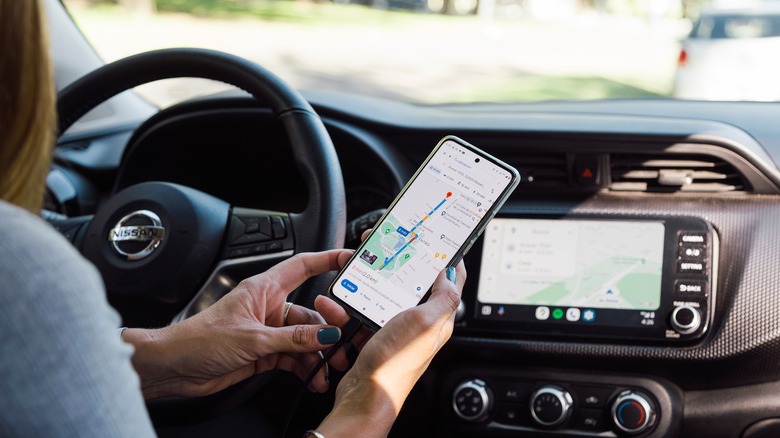
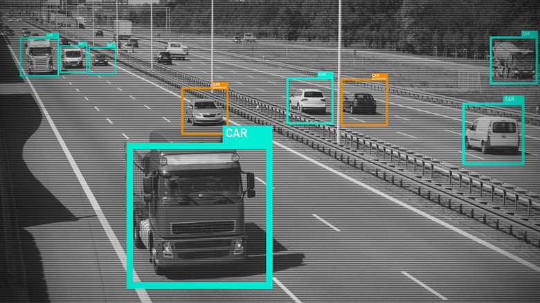
Once you open Google Maps and start using it with "My Location" enabled, you become part of the Google crowdsourcing system. Your smartphone starts sending bits of data back to Google anonymously, helping Google determine how fast it's moving. Google then combines the speed at which your and others smartphones are moving on the same road , and compares these smartphones' speeds with the speed at which smartphones have traveled your route before.
All this comparison helps Google determine real-time traffic condition in your area. If Google finds out that your smartphone and other smartphones on your route are moving much more slowly than usual, it'll indicate a traffic jam on your route. Since the crowdsourcing concept is dependent on data sent by users, the more people who use the app, the better Google Maps can predict road conditions.
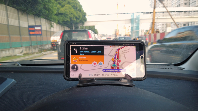
Waze uses the same crowdsourcing concept to detect traffic jams. And, like Google Maps, it uses its community to help you avoid traffic jams. Let's say you're using Waze to travel to a location and encounter a traffic jam. To avoid it, you switch to another route. Now when someone else encounters a traffic jam on the same route, Waze may suggest the alternate path you took so that they can avoid the traffic jam.
How do Waze and Google Maps know if there's an accident?
The way Waze and Google Maps detect accidents on the road is a bit different than the method used to detect traffic. Both apps depend on users so they can show accidents, and in both you have the option to report accidents.
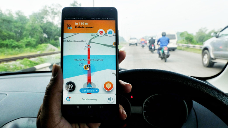
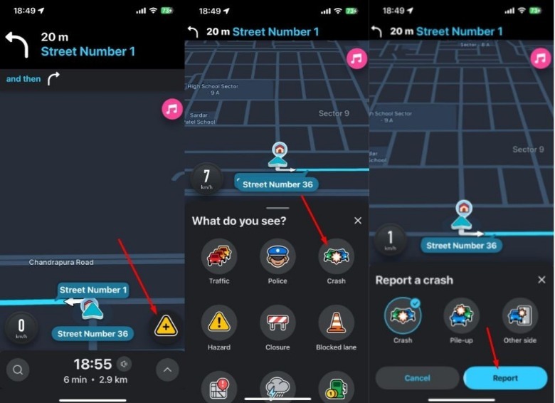
In Waze, when you find out there has been an accident on a route you're traveling, you can report it by going to its exact location, tapping the report icon in the bottom-right corner, and choosing Crash. Then, you need to select the type of crash and choose Report. Now when someone travels on that route, they'll see a crash icon on the map.
 Aman Kumar/SlashGear
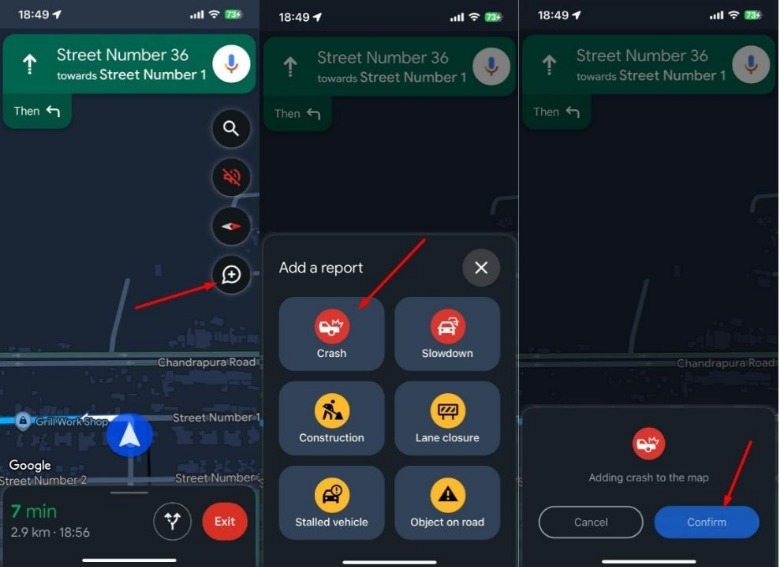
Similarly, if you want to report an accident or other problem on the road in Google Maps, you need to get as close as possible to the accident site, then tap the plus icon, choose Crash and then Confirm. You can also use Google Assistant, saying something like, "Hey Google. Report crash."
 Aman Kumar/SlashGear
Both apps will keep the crash icon on the map for a certain period unless more reports about it are submitted by other users. These additional reports help Google Maps and Waze confirm your report; their absence would suggest a false or outdated notification.