11 Of The Biggest Bridges Ever Built In The USA
The humble bridge is one of the most common transportation structures humans use. In the U.S. alone, there are over 617,000 bridges at last count. Some of them are no longer than a few yards while others are miles long. Per the American Society of Civil Engineers (ASCE), over 178 million trips are taken across U.S. bridges every day from commutes to transporting resources. Many of the bridges in the U.S. are quite old as well, with approximately 42% of bridges being over 50 years old.
As such, there are a bunch of famous bridges out there. The Golden Gate Bridge in San Francisco, California, and the Brooklyn Bridge in New York are two of the most well-known and nearly every child has heard the old song "London Bridge Is Falling Down." Most such bridges are known for their high-traffic locations, excellent architecture, or cultural impacts. However, one title none of them hold is the title of the longest bridge. That is an entirely different category with a different set of bridges.
The longest bridge in the world is the Danyang-Kunshan Grand Bridge located between Shanghai and Nanjing. It spans an incredible 102.4 miles with second place going to the Chang-hua-Kao-hsiung Viaduct in Taiwan that stretches 97.8 miles. Even though the U.S. doesn't have a bridge quite that big within its borders, there are still some bridges that take some time to get across. Here are the biggest U.S. bridges sorted by total length.
Norfolk Southern Lake Pontchartrain Bridge
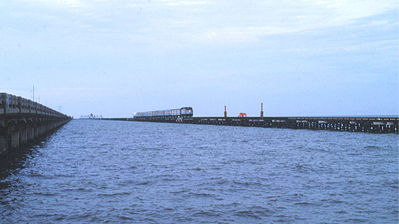
The Norfolk Southern Lake Pontchartrain Bridge is the first of many bridges featured in Louisiana thanks to its many swamps, marshes, and lakes. This particular bridge crosses a section of Lake Pontchartrain and connects New Orleans to Slidell, Louisiana. It was built in the 1880's and rebuilt again in 2005 after Hurricane Katrina took out a significant percentage of the bridge. Unlike most bridges, this one is a railroad and only trains traverse it. Trains carry passengers and cargo across the lake daily and has for over 100 years.
The Norfolks Southern Lake Pontchartrain Bridge measures 5.8 miles long or about 30,264 feet. Technically, the bridge is actually much longer. Thanks to Louisiana's abundant marshes and swamps, the bridge is actually around 15 miles in total. However, The New Orleans and Northeastern Railroad — the company that built the bridge—built embankments in the marsh area and only 5.8 miles of the bridge occurs over open water, so that is its official measurement. There are also segments where larger ships can get through as the bridge can be raised.
Over the years, the bridge has been owned and operated by a few different railroads. NO&NE was the first and operated the bridge until 1969 when it merged with Southern Railway. That company then merged with Norfolk Southern in 1990. Norfolk Southern still owns the bridge to this day. It also has the distinction of being one of the longest train bridges in the world.
General W.K. Wilson Jr. Bridge
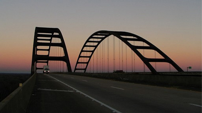
The General W.K. Wilson Jr. Bridge is one of the newer bridges on the list with a build date of 1980. It is a dual parallel bridge, which means it's actually two bridges that run parallel to each other. Each bridge has two lanes of traffic and carries people driving along Interstate 65 across the Mobile-Tensaw River Delta near Mobile, Alabama. The large arches are a hallmark of the bridge and can be seen from a fair distance away. Locals say that the view from the bridge into the Mobile-Tensaw River Delta is quite beautiful.
Officially, the bridge spans 6.08 miles or about 32,120 feet. That edges out the Southern Norfolk Lake Pontchartrain bridge by just a couple thousand feet. Much like the Southern Norfolk bridge, the General W.K. Wilson Jr. bridge carries people over the river delta and nearby wetlands, except this time there are no embankments to shorten the technical distance. In total, it goes over the Mobile River, Little Lizard Creek, Middle River, and Tensaw River. On Google Maps, it lists multiple bridges going over those rivers but it's all part of the General W.K. Wilson Jr. Bridge.
Locally, the bridge is also known as the Dolly Parton Bridge, a nickname the bridge earned allegedly from Alabama state auditor Jim Zeigler. The nickname is said to come from the fact that Parton starred in the movie "9 to 5," which came out in 1980 as the bridge was being completed.
Seven Mile Bridge
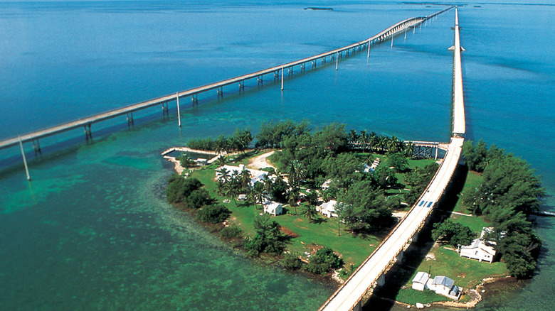
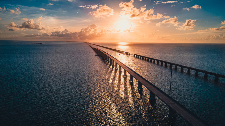
Seven Mile Bridge is one of the most iconic bridges in the U.S. and resides in Florida. More specifically, it's in the Florida Keys and connects the Middle Keys to the Lower Keys. The bridge stretches through the Atlantic Ocean to get there. Seven Mile Bridge is also one of the longest segmental bridges in the world. Segmental bridges are bridges that are built in short chunks rather than one continuous structure. The bridge finished construction in 1912 but has undergone several overhauls and rebuilds since then.
Its name is also a bit of a misnomer. It's called Seven Mile Bridge, but its actual length is actually around 6.79 miles, or around 35,851 feet. Part of what makes the measurement a little tricky is that there are actually two Seven Mile Bridges. The original was built in 1912 and lasted for several decades. The one people drive over today is the replacement Seven Mile Bridge, which finished construction in 1982. At the time of its construction, it was the longest segmented bridge in the world.
The second Seven Mile Bridge also may be nearing its end of life sooner rather than later. Officials in Florda are currently considering another successor to the Seven Mile Bridge, built to today's specifications. The current bridge is still good as of this writing but existing in salt water and getting battered almost yearly by hurricanes has taken its toll. Florida will decide whether the replacement is approved in 2026.
San Mateo – Hayward Bridge
The Golden Gate Bridge is among the most famous bridges in the world and is right up there with the Statue of Liberty and the Hollywood Sign in terms of U.S. landmarks. However, it is not the longest bridge in California. That title goes to the San Mateo — Hayward Bridge. The bridge was built in 1929. Most of it was destroyed during a retrofit in 1967 to build a larger, sturdier bridge. The bridge connects San Mateo to Hayward and crosses the San Francisco Bay.
Unlike Seven Mile Bridge, the San Mateo — Hayward Bridge is actually seven miles long or approximately 36,960 feet. At the time of its creation, the bridge was the longest in the U.S. and would remain that way until the 1950's. Another interesting factoid is that the original San Mateo — Hayward Bridge measured 7.1 miles while the newer bridge registers at seven miles, meaning that the redesign made it just a touch shorter than the original. Other than a couple of closures to deal with Lima Prieta Earthquake, the bridge has otherwise been in regular operation aside from the occasional widening or repave.
In addition to being very long, it's also a toll bridge. The company that built the bridge charged drivers $0.45 to cross the bridge for the first few decades of its life. In 1951, California bought the bridge for $8.35 million and celebrated by lowering the toll to $0.35. Today, that toll costs $8.00.
Jubilee Parkway Bridge
The Jubilee Parkway Bridge is another bridge from the deep south. It's a parallel concrete viaduct bridge that connects Mobile to Spanish Fort, Alabama. Viaduct bridges are unique in that they are bridges that go over both water and land in areas where there are rivers, lakes, valleys, or other roads. That means part of this bridge is over water and some of it is over land. Construction of the Jubilee Parkway Bridge was completed in 1978, which means it's fast approaching its 50th birthday.
The bridge officially measures 7.5 miles, or about 39,600 feet. It crosses the northern tip of Mobile Bay near where the Apalachee and Blakeley Rivers feed into the bay. Thus, the bridge is mostly over water but does cross some small landmasses on its way there. It's a prominent part of Alabama's Interstate 10 highway and features four lanes of total traffic. The bridge has also undergone several modernizations, with more potential expansions and renovations coming in the future.
Jubilee Parkway doesn't have the most interesting history but there are some fun facts. It is known as Bayway to the locals and is often referenced as such in the local news. It is not to be confused with the Causeway—officially Battleship Parkway — which is a series of smaller bridges that are also nearby. Jubilee was also the home to one of the largest multi-vehicle collisions in U.S. history with more than 200 vehicles involved, resulting in 90 injuries and one fatality.
Louisiana Highway 1 Bridge
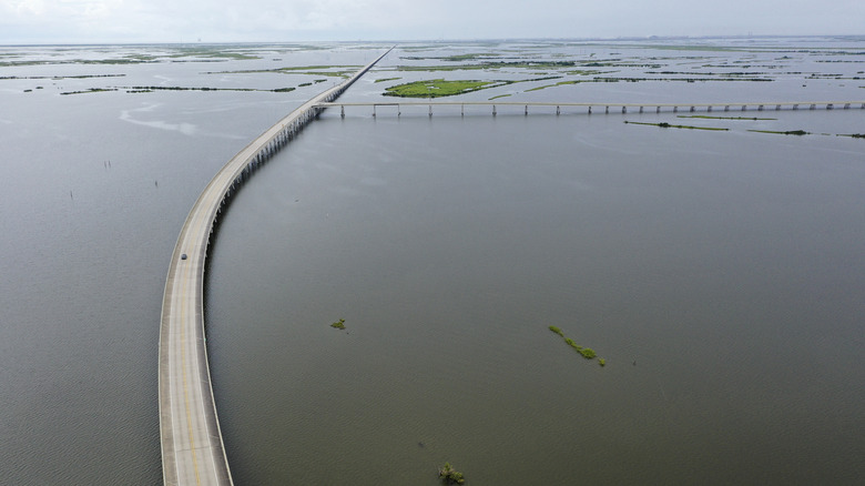
From this point forward, all of the remaining bridges on the list except for one are from Louisiana. Let's start with the Louisiana Highway 1 Bridge. This bridge is part of a larger series of bridges and lifted highway that connects Golden Meadow to Port Fourchon, Louisiana. It is the newest bridge on the list and that's mostly because it hasn't been finished being built yet. Many parts of the bridge are open to traffic currently and the bridge completion is scheduled for some time in 2025.
That makes true length a little tricky to calculate. Louisiana Highway 1 runs through myriad swamps and marshes and juts across several lakes. In total, the elevated highway and all bridges combined are approximately 17 to 18 miles long. However, the longest individual stretch of bridge is just south of Leeville and is known as the Gateway to the Gulf Expressway. It stretches for about 8.5 miles, or about 44,880 feet.
The bridge was built as an improved way to transport people and supplies to and from the Gulf of Mexico. It also replaces an older bridge that was originally built in 1940 and was removed in 2022. What makes the Louisiana Highway 1 Bridge so interesting is that its length is entirely up to who you ask. Louisiana's Department of Transportation puts the length at around 18 miles while others only count the expanse between Leeville and Port Fourchon, which is about 8.5 miles as measured on Google Maps.
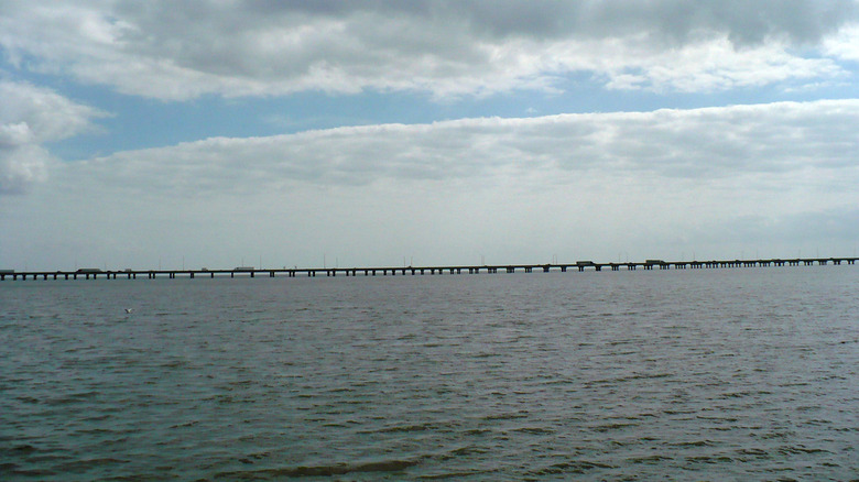
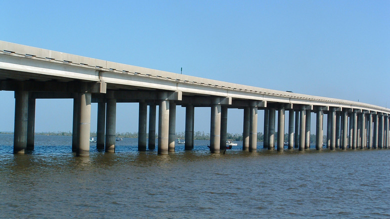
I-10 Bonnet Carré Spillway Bridge
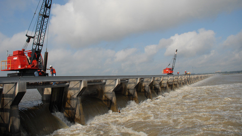
The I-10 Bonnet Carré Spillway Bridge is a twin concrete trestle bridge in Louisiana. Trestle bridges are fairly common thanks to the trestle frames, which are known to be quite sturdy when built correctly. The bridge first opened in 1936 and is located about 30 miles north of New Orleans, Louisiana and runs along the western edge of Lake Pontchartrain along with the Bonnet Carré Spillway and the LaBranche Wetlands.
The bridge's length varies a bit depending on who you ask with most people saying that the bridge is about 11 miles, or approximately 58,000 feet and some change. That makes it longer than most bridges in the U.S. and either a bit longer or a bit shorter than the Louisiana Highway 1 Bridge, depending on who you ask. It's named for the Bonnet Carré Spillway, which carries overflow water from the Mississippi River to Lake Pontchartrain and the bridge crosses that expanse as part of its journey.
Interestingly, this bridge is a hop, skip, and a jump away from the Manchac Swamp Bridge and the Lake Pontchartrain Causeway Bridge. The three form a U-shape that stretches north and west out of New Orleans. Before the three bridges were built, it was intensely difficult to get into and out of New Orleans with only a acouple of highways that meandered around the marshes and swamps. The bridges made it much faster to carry people and cargo into and out of the big city.
Chesapeake Bay Bridge-Tunnel
The Chesapeake Bay Bridge-Tunnel is the longest bridge in the U.S. that isn't in Louisiana. The bridge carries people from the Norfolk and Virginia Beach areas of Virginia across the Chesapeake Bay to the southern tip of the Delmarva Peninsula, which is shared by Virginia, Delaware, and Maryland. Construction began in 1958, and the project was completed in 1964. It is not only a valuable path across the Bay that cuts travel time by many hours but is also a tourist attraction for people visiting the area.
Like most bridges, there are some caveats when it comes to length. The overall length of the Chesapeake Bay Bridge-Tunnel is 17.6 miles from shore to shore. However, as the bridge's name implies, there are also some tunnels that run along the expanse. Specifically, two one-mile tunnels interrupt the bridge so that ships can still enter and leave the Bay without the bridge getting in the way. Even with the tunnels, it's still over 15 miles worth of bridge. The Chesapeake Bay Bridge-Tunnel was given a parallel bridge to help accommodate increasing traffic in 1999.
It is also a bridge with many names. The locals often refer to it as the Bay Bridge or simply CBBT for short. Its official name is the Governor William Preston Lane Jr. Memorial Bridge, named for the 52nd governor of Maryland. Its first name was the Lucius J. Kellam Jr Bridge-Tunnel in honor of the man who spearheaded the project
Atchafalaya Basin Bridge
We return to Louisiana for our final three bridges, and we'll start with the Atchafalaya Basin Bridge. The bridge runs along Interstate 10 west of Baton Rouge, Louisiana. The parallel bridge helps travelers get from Lafayette to Baton Rouge. Unlike most bridges, which are straight across, there are two additional exit points for the Atchafalaya Basin Bridge. The first empties out on Atchafalaya River Highway, which takes passengers to Butte La Rose while the other drops travelers next to the Whiskey Bay Pilot Channel. The highway-style exit ramps give the bridge a total of four entry and exit points.
Fortunately, the length for Atchafalaya is fairly well known as it is one of the longest bridges in the world. The bridge spans a total of 18.2 miles or around 96,100 feet. Most of its travel takes place over rivers and marshland so it counts as one big bridge even if it's not entirely over open water. A fun fact with the Atchafalaya Bridge is that it also merges with itself. For most of its journey, it's a parallel bridge. However, the bridge merges and becomes a single bridge when it crosses over Atchafalaya River and again when it hits the Whiskey Bay Pilot Channel.
The bridge carries more than 50,000 vehicles per day on average, which has prompted regulations to help avoid traffic accidents. For example, 18-wheeler trucks have to stick to the right lane and the speed limit is a balmy 60 MPH.
Manchac Swamp Bridge
The Manchac Swamp Bridge is the second largest bridge in the U.S. in terms of overall length. It runs along the western bank of Lake Pontchartrain and the eastern bank of Lake Maurepas. The span between the two lakes is fairly thin and results in a ton of swamps and marshes, which is why the bridge was built. It made travel much easier to New Orleans without needing to go around the nearby lakes when approaching from the north. The twin concrete trestle bridge opened for business for the first time in 1979.
At 22.8 miles—or approximately 120,384 feet—the Manchac Swamp Bridge is the first entrant to cross the 20-mile milestone. It is one continuous expanse, so there are no doubts about the length of this one. It's also one of the least busy bridges in Louisiana with only about 2,250 drivers crossing it per day. That pales in comparison to something like the George Washington Bridge in New York, which sees nearly 300,000 travelers per day. The existence of the Lake Pontchartrain Causeway Bridge probably has something to do with that as it's an even more direct route to New Orleans.
On top of being long, the Manchac Swamp Bridge is also known for being haunted. As the local legends go, the bridge was built over top of a swamp haunted by a voodoo princess named Julia Brown, who cursed the area upon her death. Fortunately, the bridge hasn't suffered any ill effects of the curse.
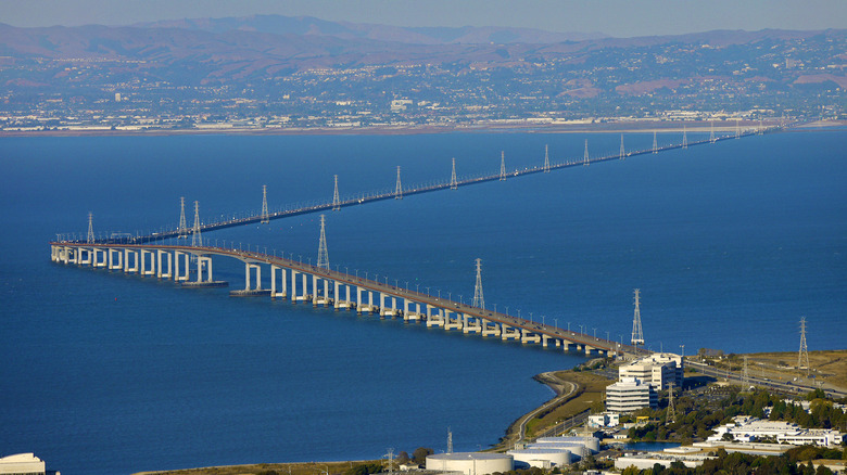
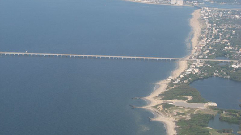
Lake Pontchartrain Causeway Bridge
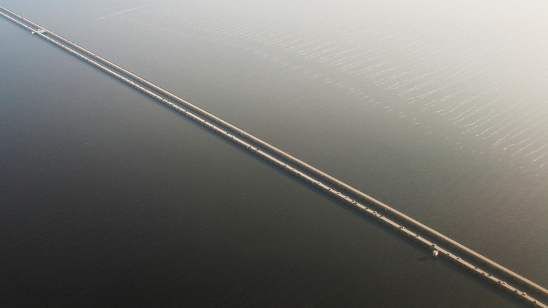
The Lake Pontchartrain Causeway Bridge currently holds the record as the longest U.S. bridge and a top 10 contender for longest bridge in the world. It's a parallel bridge that cuts right through the center of Lake Pontchartrain, hence the name. It connects travelers heading south right into New Orleans and approximately 40,000 people make the epic trip across the lake per day. The first bridge in the twin setup was completed in 1956 while the other was added in 1969.
In terms of length, the bridge is just shy of 24 miles long, or approximately 126,000 feet. Despite being twins, the bridges are actually slightly different lengths. The second bridge that was built is 50 feet longer than the first, giving that half of the Lake Pontchartrain Causeway Bridge the record for the longest bridge in the U.S. over its sibling. Despite their massive lengths and constant exposure to water, the bridges are in relatively decent condition even after being battered by several hurricanes.
The bridge, known as The Causeway to locals, has a couple of specific records. It currently holds the Guinness World Record for the longest bridge over continuous water. Most long bridges traverse over a combination of lake, river, swamp, marsh, or dry land. Even the Seven Mile Bridge hops over some islands. The Causeway is unique in that its entire expanse is strictly over open water, making it the longest such bridge in the world to do so.