4 Of The Highest-Rated Wildfire Tracking Apps Available (iPhone & Android)
Wildfires are a common occurrence in several places in the country, even more so now that climate change is becoming an even bigger threat. If you live in an area near the wildlands — especially if you're located in the western portion of the U.S., where wildfires can spread at an alarming rate — or know someone who does, being vigilant during the summer and fall when extreme fire events are known to occur or when there's an ongoing drought or lack of rainfall is almost essential. You need to know if there is an impending threat to your safety and whether there is a need to relocate.
Apart from keeping abreast with current events and local news, another helpful thing to consult is an app that tracks fires. There are plenty available for both iOS and Android mobile devices, but some are more useful than others. To help you figure out which tracking app to use, we've compiled a list of the best-rated options on both the Apple App Store and Google Play Store. Recommendations are based on the number of user reviews, the app's current star rating on its respective app marketplace, and the overall usefulness of available features.
Google Maps
Google Maps — which has over 18.5 million reviews on the Play Store and is currently the number one navigation app in the App Store — has a few seemingly hidden features, including a built-in crisis-related alert function that let users know when there's an emergency event happening within your vicinity. Time-sensitive notifications are designed to pop up when you search for an area or select a navigation route that enters a map portion that has an ongoing crisis such as floods, earthquakes, and wildfires, among other things.
Google Maps' active wildfire detection works by using Google Earth Engine along with data procured by the National Oceanic and Atmospheric Administration's satellites. This along with infrared technology used to determine hot spots are utilized to create wildfire boundary maps. Additional information is also provided, including safety advice from local authorities that include nearby shelter and evacuation locations.
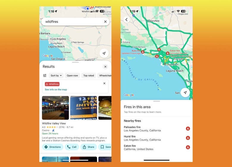
To garner updates about active wildfires on Google Maps, tap the Layer icon in the top-right or bottom-left corner of the map area and select Wildfires under Map Details. You can also type "wildfires" or the specific name of an individual fire (usually the one used in news broadcasts) into the Google Maps' search box and tap the result that bears the red Wildfires banner.
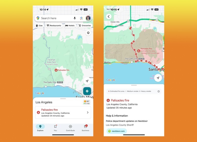
Finally, if you're zoomed into a map area that has an active fire, tap on the fire alert banner that pops up in the Explore card on the Google Maps home screen. That will turn on the layer and show the coverage area of the wildfire.
Note that in some locations, the Wildfires layer might show up as Bushfires instead. In addition, to ensure that you see all the relevant information about an ongoing wildfire, zoom in on the map area you know has a crisis in progress.
Windy.com
Windy.com is a highly downloaded forecast app — currently has 4.8 out of five stars and is number six in the App Store's Weather app category, plus has 4.7 out of five stars and has the Editor's Choice badge in the Play Store — that has a real-time radar view that shows you accurate weather conditions. Upon first launch of the app, you may be asked what sort of activities you'd like to use the app for — such as outdoor sports and activities, agriculture, aviation, or meteorology, among others — but you can skip that for later.
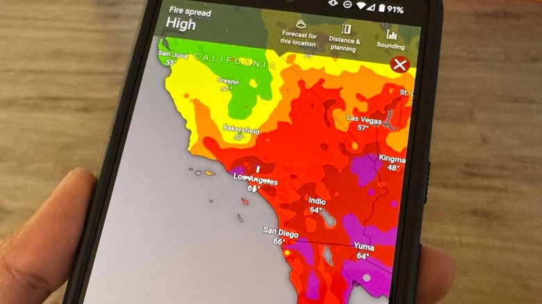
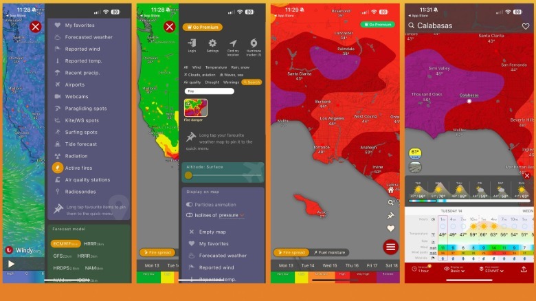
Once you get to the main map, you may immediately see ongoing weather movement. When you tap the hamburger icon, you'll see the various layers you can use to get the type of weather data that you want. Scroll down and select Active Fires under the Display on Map section and use the Layer Search function to look up and activate Fire Danger. After you exit the side panel, the map should update with appropriate color codes for severity of ongoing fire spread.
To get more detailed information on a specific place, tap on the area and hit Forecast For This Location at the top of the screen, or tap on the city name. This will show a card that has more fire-related metrics, such as wind speed and wind gusts.
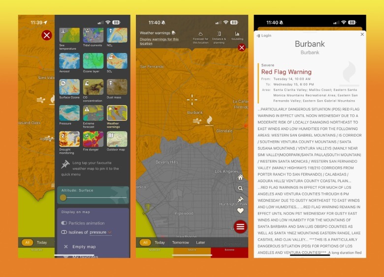
You can also activate the Weather Warnings layer, tap on the weather warning icon on the area you're looking into, and hit Display Warnings For This Location to see what the local government is saying about the ongoing wildfire.
IQAir Air Visual | Air Quality
When there's a wildfire, one of the most crucial things to keep an eye on is the breathability of the air in neighboring areas. IQAir — currently the third-best weather app in the App Store with 4.8 stars and has 4.7 stars and over 5 million downloads in the Play Store — is an app that you can use to make sure that people you know in the vicinity of a place impacted by an ongoing fire are safe to stay where they are or where they plan to move to. This is especially important for people with allergies, asthma, and other relevant limitations.
What the app does is collate data from users who have an IQAir air quality monitor installed in their home. You don't need to have one yourself to use the app — just select Continue Without Installing A Device and joining as a guest when you launch the app.
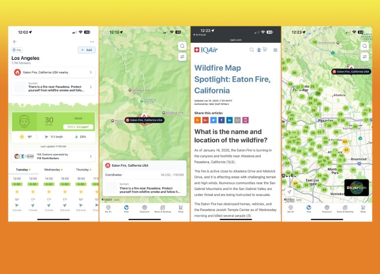
Once you get to the home screen, tap Add A Place under "Search for places anywhere in the world" and plug in the name of the area you know has an ongoing fire. Choose from the list of suggestions, or manually add your own.
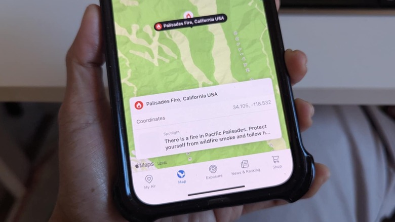
While the app may indicate that the current air quality is "good" in a location near an ongoing fire, there should be a notification on the page about it on the location's page. Tap the fire icon and hit the Spotlight link to read information IQAir has in terms of what communities are affected, what the fire containment status currently is, and whether or not there are any ongoing evacuation orders in place. You can also zoom out and look around neighboring areas to see what the air quality is like.
Watch Duty
What is perhaps the most popular wildfire tracking app to date is Watch Duty. It's got 4.9 stars in the Play Store as well as the App Store. It's a community-based service that provides real-time information and maps out wildfires based on reports submitted by people on the ground. Data is vetted by active and retired wildland firefighters, dispatchers, and first responders as well as reporters.
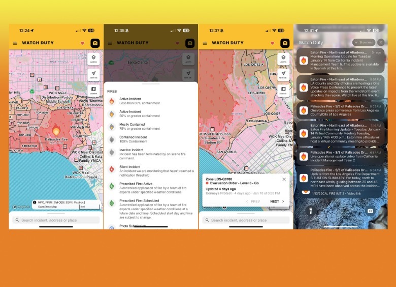
This app is especially useful for people in the vicinity of an ongoing fire. The Watch Duty team will notify affected users via the app if there are any crucial updates worth noting, such as smoke, wind, and air quality notifications, evacuation order details, and similar data. To enable notifications, tap the hamburger icon on the main Watch Duty screen, select Notifications, and add the county you'd like to track.
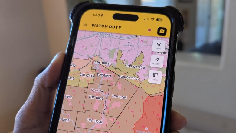
The fire map is color coded according to crisis severity. Any fire icons on the map will indicate the percentage of containment. Tapping on a specific map zone will show you any evacuation orders and flag warnings that are currently in effect. Also on the map are places that offer temporary shelter for humans and animals, as well as meal distribution and evacuation centers in case you need it.
