11 Of The Best Apps To Track Hurricanes On Android And IOS
Every year, hurricanes cause major catastrophes around the world, with some regions being hit harder than others. For instance, areas near the Central-Eastern North Pacific Ocean and North Atlantic Ocean are particularly vulnerable to these tropical cyclones, and in the U.S., southern coastal states like Florida and Louisiana are known to record significantly higher occurrences than other areas.
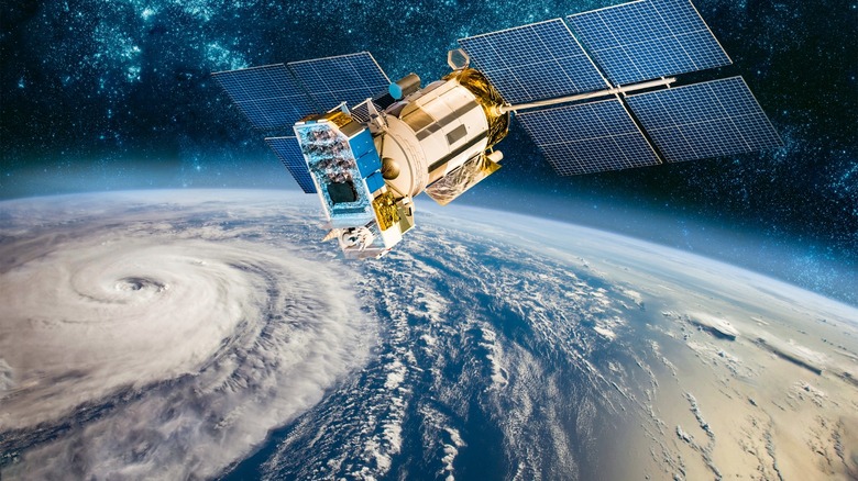
Given that hurricanes cause more damage and fatalities than any other weather disaster in the U.S. — and have a significant global impact — efforts have increasingly focused on using technology to predict and minimize their devastating effects. Software companies have developed apps that track hurricanes and provide crucial information to help people prepare during these emergencies. In highly susceptible areas, these tools are basically a must-have.
While some of these apps are data-intensive and suitable for meteorologists and other professionals, others are designed with more user-friendly and interactive features for the general public. Ultimately, they all aim to provide enough foresight to significantly reduce potential damage from hurricanes.
Here are 11 of the best apps to track hurricanes on Android and iOS.
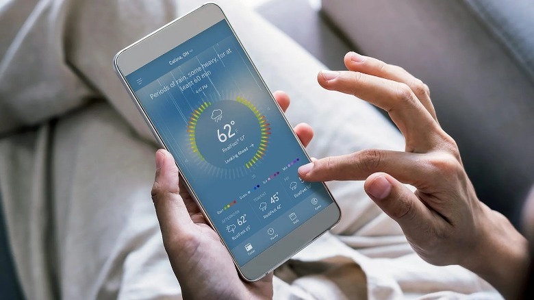
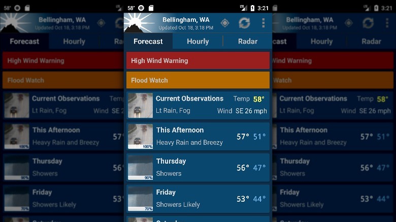
Ventusky
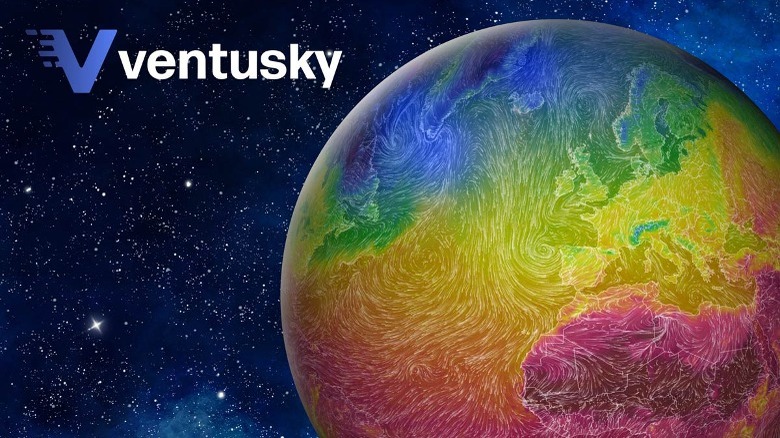
Ventusky stands out for the wealth of data it offers. The app displays everything from humidity levels and atmospheric pressure to precipitation, wind, freezing levels, and detailed weather forecasts — all on a beautifully animated interface. Available for both iOS and Android, Ventusky is entirely ad-free but offers both free and premium versions, with the premium unlocking extra data insights.
The app is user-friendly, opening to a 3D weather map that typically shows the conditions within that location. However, users can easily adjust it to view weather data for the entire country or even globally. This map clearly displays wind direction along with other relevant details like temperature.
In addition to basic weather tracking, Ventusky is great for providing helpful hurricane predictions, and offering data on wind speed, gusts, and satellite imagery. The main drawback is that some of its most useful features, like wind levels, cloud cover, and air pressure, are only available on the premium version.
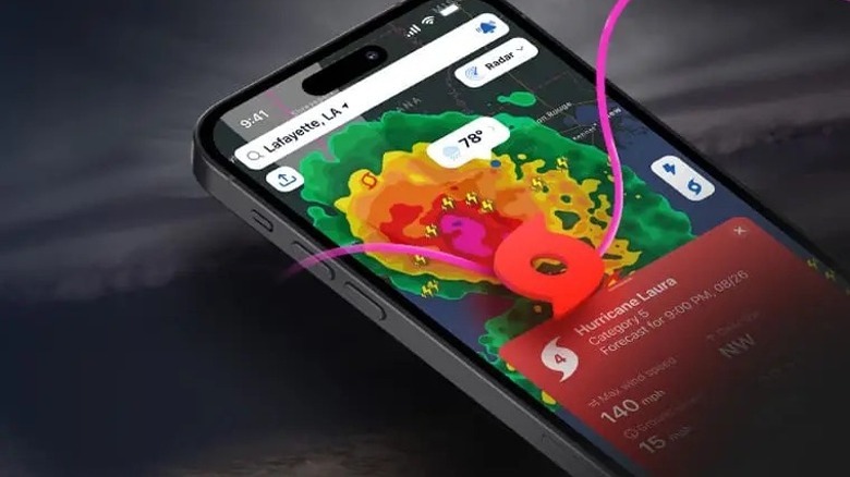
Windy.com
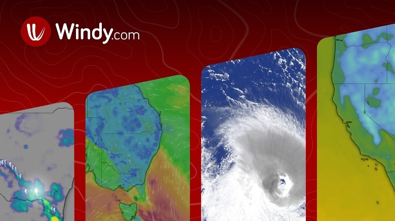
Windy.com is a top-rated tool for tracking storms and monitoring severe weather conditions, available on iOS and Android devices. The app provides all the needed weather data at the highest resolution. In addition, its global data insights, coupled with numerous comprehensive tools, allow users to monitor weather patterns around the world.
Part of what makes Windy a leading platform is that it invests in and utilizes the most accurate and reliable weather models for data collection and forecasting. The app uses highly rated global models like the ECMWF and GFS along with regional models such as ICON-D2, HRRR, and ACCESS for precise weather predictions. These tools allow it to display various insightful weather data made for both regular users and professionals like pilots, surfers, and fishermen. Not just that, it also enables them to customize alerts based on their needs and preferences.
Windy.com mostly stands out for its in-depth insights into rainfall and wind patterns, but it is also specifically equipped with a storm and hurricane tracking tool. This feature allows users to monitor the path of a hurricane and see the predictions from various weather models.
Although you get more features and an ad-free experience when you pay for its premium version, the free version is comprehensive and offers a ton of useful data.
RadarOmega
RadarOmega keeps users up-to-date with rapid weather changes by providing real-time, high-resolution data. It offers a wide range of weather data, using Multi-Radar/Multi-Sensor (MRMS) data, satellite imagery, the National Digital Forecast Database (NDFD), and models like RRRR and NAM 12 kilometers. Available on both iOS and Android, RadarOmega is designed for users who want accurate weather tracking on the go.
One of RadarOmega's standout features is that it offers users the ability to customize their experience by creating their own custom data layers, frame animations, and display settings. It also boasts of high-resolution radar products, which offers clear, precise data on things like reflectivity, which shows the intensity of precipitation (rain, snow, and hail), and velocity, the direction and speed of the wind. These are useful in tracking severe weather conditions and storms.
RadarOmega collects data and outlooks from organizations such as the National Hurricane Center, National Weather Service, and Storm Prediction Center. This way, you can get reliable forecasts and warnings when there is incoming severe weather or flooding. Coupled with the real-time alerts issued by the National Weather Service, the app is a comprehensive tool for navigating hurricanes and other hazardous weather.
AccuWeather App
AccuWeather is a leading American media and forecasting company, well-known among weather enthusiasts. This company, which has been around since the 1960s, has been dedicated to helping people understand the impact of weather so they make informed decisions that ensure their safety. Launched in 2011 and now available on iOS and Android, the AccuWeather app was designed to help not just navigate daily weather decisions but also provide timely tropical storm radar tracking. Its contributions have since earned it some recognition and awards by the World Meteorological Organization.
The app's main page displays the current weather conditions, including wind speed, UV index, visibility, and pressure, providing hyper-local forecasts. It features RealVue satellite imagery, which gives a realistic weather map view from space, including elements like clouds, fog, and smoke. Generally, this software focuses on helping users conveniently plan around daily weather conditions, and navigate severe weather conditions like hurricanes, providing predictions up to 45 days ahead.
One of the main perks of AccuWeather is its accessibility. It's quite easy to use and available in so many languages. However, on the flip side, the app features a lot of ads, which can be annoying, and many of its great features are relegated to the premium version.
Clime
Developed by Easy Tiger Apps, "Clime: NOAA Weather Radar Live" was released in 2013 to provide accurate, real-time weather alerts that keep users informed and safe in the event of a storm or other weather hazard. Though the app is primarily available in the U.S., Germany, and China, it offers radar images for a wide range of locations globally, including Japan, France, Poland, Australia, and the Netherlands. It is available on the Apple Store and Google Play and has great user ratings on both platforms.
Clime features an interactive satellite map that displays cloud cover, radar overlays, and precipitation levels, along with 24-hour precipitation forecasts. When there are any upcoming serious weather changes, users get timely notifications and can also warn family and friends about it using the weather-sharing feature.
The app also lets you switch between weather models and select wind, speed, and temperature units. However, you'll need to subscribe to the premium version to unlock some of its features, like hurricane tracking, the air quality index, and temperature maps. It's also worth noting that the app also offers offline hurricane tracking, which is great during extreme weather that affects your internet connection.
FEMA App

The FEMA App is an emergency resource that was recently introduced by the U.S. Federal Emergency Management Agency, the leading governmental body for crisis management. This software uses data from the National Weather Service to help people effectively navigate weather disasters. The goal of the government was to have a tool to help keep individuals, families, and communities safe during these emergencies.
The FEMA App is unique for its holistic approach. It helps you plan ahead of a natural disaster like a hurricane, with information like what to include in an emergency kit and how to maintain communication with family members. The app also helps you locate nearby emergency shelters using the Integrated Public Alert and Warning System (IPAWS). It also provides tools for recovery through the organization's disaster resources. Several locations that are eligible for assistance get access to these recovery tools.
Essentially, beyond tracking hurricanes, the FEMA app is a great tool to have during other severe weather emergencies. Available on both Android and iOS, it is entirely free to download and use, with no subscription model.
MyRadar
The MyRadar weather app stands out with its hyper-local forecasting and accurate prediction features. Since its release in 2009, it has gathered several notable awards for its expertise and exceptionality in weather forecasting. The app, compatible with both iOS and Android, was created by Aviation Data Systems and is available in the United States, Canada, and Japan.
MyRadar features an animated live radar that gives users access to on-the-go weather insights. The app, which uses hi-def radar, offers all the general features of a weather app, with detailed weather forecasts, nationwide temperatures, and NOAA weather alerts.
Beyond these, it also boasts more advanced features like real-time hurricane tracking on the premium version. This feature allows users access to the probability cone, a graphical tool that tracks the potential path of a hurricane as well as its probable intensity to help users understand where a cyclone is headed. The app also incorporates information from the National Hurricane Center for additional insights.
MyRadar offers optional alerts on the activity of hurricanes or other severe weather conditions as they form and progress, making it a great tool during the hurricane or stormy season.
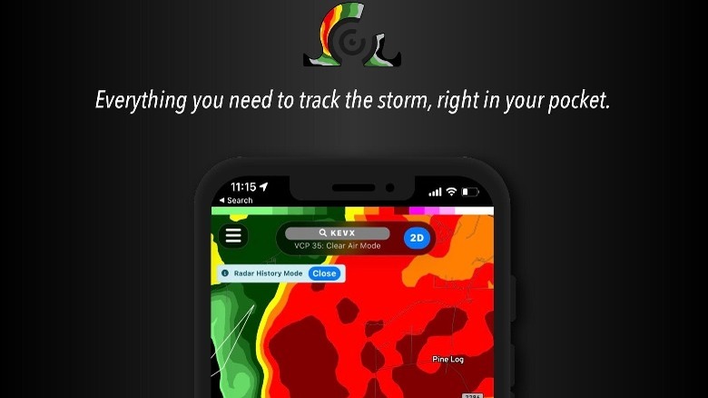
RadarScope
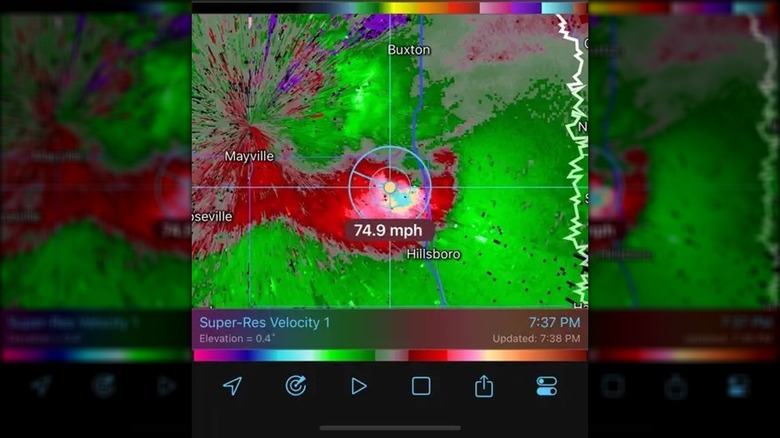
RadarScope is one of the best weather apps you'll find. However, it is better suited for meteorologists and passionate weather enthusiasts than the average user because of its heavy-duty data. It's a powerful weather tracker, providing detailed insights gathered from radar sites in the United States, Korea, Australia, and Canada. The app is built to track severe weather conditions like hurricanes, thunderstorms, tornados, and flash storms.
What makes RadarScope stand out is its detailed weather information and high-resolution data. It lets you view Super Resolution Data as well as Next Generation Weather Radar (NEXRAD) level 3 data for detailed and original radial data. On the app, you can choose from up to 289 radars, view data values, and pinpoint up to 25,000 different locations.
The app has two subscription models: The Pro Tier and the Pro Tier 2, priced at $10 and $15 per annum, respectively. The Pro Tier 2 gives access to one of its standout features — dual polarization, which enhances the accuracy of weather radars by distinguishing between different types of precipitation. The app is available on iOS and Android and is also compatible with Windows and Mac devices.
Tropical Hurricane Tracker
Created by JPL Technical Solutions, Tropical Hurricane Tracker stands out for its user-friendly and easy-to-use interface. Available for iOS and Android, the app gives users access to insightful, up-to-date information on various weather conditions over an extensive area.
Apart from regular weather updates, this app features hurricane tracking maps by region, covering the Atlantic, Eastern North Pacific, and Central Pacific, allowing users to view hurricanes' history and predicted paths. It incorporates the Saffir-Simpson hurricane Scale, which measures maximum wind speed and estimates the potential impact and damage during hurricanes, to guide emergency response.
Tropical Hurricane Tracker is also equipped with ensemble models, a numerical prediction method that generates a range of forecasts instead of single predictions. This is to ensure better accuracy while preparing for various possibilities and uncertainties. Apart from this, the app provides weather NOAA forecasts, historic storm tracks, and an interactive global map.
NOAA Weather Unofficial
The NOAA Weather Unofficial app is another must-have tool for hurricane and weather tracking in general. Although this platform is not affiliated with the National Oceanic and Atmospheric Administration, it makes use of data provided by the organization, which is made available to the public. The app provides regular updates on weather forecasts and uses an animated radar to display insightful data on an easy-to-use interface.
The NOAA Weather Unofficial app focuses on displaying weather information that is most relevant to its users. It uses the mobile GPS to get hyper-local and accurate predictions or may alternatively use information from nearby cell towers and WiFi networks. Data from the NOAA and National Weather Service also help in providing more personalized data insights.
The app has a pro version, which is actually a separate app available on the Google Play store. This version has no ads or restrictions, whereas the standard version features ads and limits users to three saved locations.
Apart from this, the app has a few other downsides: It doesn't provide severe weather alerts or notifications, which could be critical during emergencies, and it's limited to U.S. data only. Also, the app is only available on Android.
National Hurricane Center Data
National Hurricane Center Data contains comprehensive features for weather tracking. This app, which is only available for iOS, was created by LW Brands, LLC, a weather and lifestyle software development company. The app provides a range of products that make weather monitoring easy and interactive, incorporating tools like weather map overlays and displaying NOAA weather radar, hurricane tracking, and even NASA sea surface temperature.
The app displays a range of graphical products that display various weather predictions, including three-day excessive rainfall outlooks, seven-day tropical weather outlook, and seven-day quantitative precipitation forecast. It uses spaghetti models, which help users track the patch of a tropical cyclone and assist in planning ahead of a disaster.
In addition, National Hurricane Center Data provides insights into local storm and severe weather threats, including rainfall, wind, tornados, flooding rains, and surges. However, it's relevant to note that these graphics become available only shortly before a storm's landfall, when predictions are more certain.
The pro subscription version of the app gives access to high-resolution imagery and various additional weather models.