How NASA Is Using Satellites To Protect Tigers, Jaguars, And Elephants
While many NASA missions look out into space from Earth, some are based in space but look back at Earth. Earth observation missions are important for studying the changing climate, and NASA has a large number of missions like PACE and GOES which observe different aspects of Earth's environment. But these missions aren't only important for observing Earth's climate — they can even be used to track populations of endangered animals.
NASA missions are used to track the habitats of animals like tigers, jaguars, and elephants, which are threatened by the loss of their habitats. The destruction of these habitats can be observed from space, with programs like NASA's Ecological Conservation program.
"Satellites observe vast areas of Earth's surface on daily to weekly schedules," said Keith Gaddis, ecological conservation program manager at NASA. "That helps scientists monitor habitats that would be logistically challenging and time-consuming to survey from the ground — crucial for animals like tigers that roam large territories."
NASA uses data from instruments like the Visible Infrared Imaging Radiometer Suite (VIIRS) and Moderate Resolution Imaging Spectroradiometer (MODIS) imagers, and Landsat satellites for this project, which can observe these large areas that would be difficult for ecologists to search from the ground.
Working with the Wildlife Conservation Society (WCS), NASA has developed a tool to use data from its Earth observations to track tiger habitat in real time.
Mapping animal habitats
Although tiger habitats are declining globally, the researchers using the new tools were also able to identify areas of forest which didn't currently have tigers but which could support them in future. These regions could be restored to make them appropriate for encouraging tigers to live there, potentially increasing their habitat.
"There's still a lot more room for tigers in the world than even tiger experts thought," said lead researcher Eric Sanderson, vice president of urban conservation at the New York Botanical Garden. "We were only able to figure that out because we brought together all of this data from NASA and integrated it with information from the field."
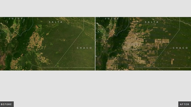
As well as tiger habitats, researchers are also looking at the habitats of jaguars, which are threatened in their homes in South America. Here, researchers used data from NASA satellites to map out areas for conservation based on habitats that were used by jaguars as well as other animals, which could be protected from threats like deforestation.
"Managers and conservationists could use the new spatial information to see where current forest zoning is protecting key animals, and where it may need re-evaluation," said lead researcher Sebastian Martinuzzi of the University of Wisconsin–Madison.
Another study looked at African elephants, using the amount of vegetation in the areas where elephants prefer to spend time. They found that elephants wanted dense canopy forest more than open areas where humans are present, helping conservationists decide which habitats are most important to protect.

