This Incredible Interactive Map Lets You Explore The Surface Of Mars
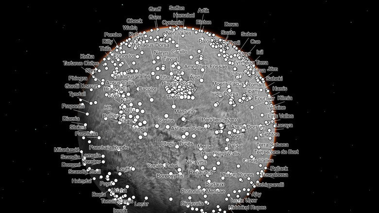
Now you can explore Mars from the comfort of your home, as NASA's Jet Propulsion Laboratory (JPL) recently shared an annotated, interactive map of the red planet showing some of the hottest sights on our neighboring world. The map was made by researchers at Caltech using data from various NASA missions. The 110,000 images that went into the map were collected by NASA's Mars Reconnaissance Orbiter (MRO), a venerable spacecraft that was launched in 2005 and has collected some of the most beautiful images of Mars as seen from orbit. The spacecraft has three cameras including its high-resolution color camera HiRISE, or High-Resolution Imaging Science Experiment, which captured its most iconic images, and a wide-angle camera called MARCI.
But the images for the map came from a context camera called CTX that takes black and white images with a resolution of up to 20 feet. For the map, the 110,000 images used cover around 270 square feet per pixel, which is enough to see the key features on the planet's surface. Now you can browse around the planet and see many of the images taken by the spacecraft over the many years it has been orbiting Mars. "For 17 years, MRO has been revealing Mars to us as no one had seen it before," said Rich Zurek, MRO project scientist at JPL. "This mosaic is a wonderful new way to explore some of the imagery that we've collected."
Details to investigate on the map
If you head to the map website, you'll get an overview of the planet. Then you can use the buttons at the bottom to zoom into some of the most important locations on Mars, such as the Jezero Crater where the Perseverance rover is currently exploring, or the Gale Crater where the Curiosity rover is located. There are also links for visiting the locations of now-defunct rovers like Spirit and Opportunity.
Some of the other fun locations to visit are of geological interest, like Olympus Mons, a shield volcano that is the largest mountain in the solar system and which stands two and a half times the height of Mount Everest. Other places not to miss are the Valles Marineris canyon system which stretches over 2,500 miles long and goes as deep as 4 miles down, and the Medusae Fossae formation which is a strange and dramatic landscape sculpted by volcanic activity.
Or you can just browse around the planet's surface, enjoying the mosaic, which has an incredible total of 5.7 trillion pixels. The researchers who created the map spent six years working on it, and it was designed for scientific work as well as for the public to enjoy. "I wanted something that would be accessible to everyone," said image processor Jay Dickson of Caltech's Bruce Murray Laboratory for Planetary Visualization, who led the project. "Schoolchildren can use this now. My mother, who just turned 78, can use this now. The goal is to lower the barriers for people who are interested in exploring Mars."
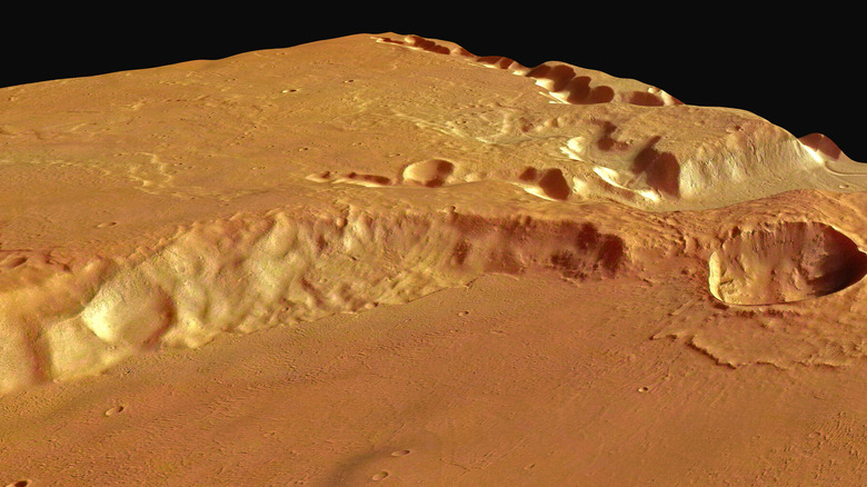
[Featured image by ESA/DLR/FU Berlin (G. Neukum) via ESA | Cropped and scaled | CC BY-SA 3.0 IGO]
How the map was made
The Mars Reconnaissance Orbiter's CTX camera is primarily used to get an overview of the planet's surface so that researchers know which targets to image with the higher resolution HiRISE camera. That means CTX images aren't often seen by the public, but they are still an incredible resource. As MRO orbits around Mars, the CTX camera has taken images of practically the entire surface, making it the obvious choice for creating a map.
However, stitching together thousands of images into one map isn't something that could be done manually. Instead, the development team at the Caltech Murray lab created an algorithm that would match up images and place them into a mosaic. Then they could add in the remaining images which the algorithm couldn't place by hand.
Other Mars scientists weighed in as the mosaic was being created, as they were also excited to see the planet mapped out like this. "I've wanted something like this for a long time," said Mars scientist Laura Kerber of JPL. "It's both a beautiful product of art and also useful for science."


